
Shelbyville ZIP Code Directory Coverage
Shelbyville has three confirmed ZIP classifications, but they are not three comparable neighborhood lists. USPS delivery geography serves mail, while city limits, county parcels, and planning records use other boundaries. The table records what the research supports and leaves out unconfirmed neighborhood lines, carrier routes, and ZIP-specific population counts. For a single address, the live USPS result is the current postal check because preferred city display and delivery assignments can change.
| ZIP | Areas Covered | Post Office | Notes |
|---|---|---|---|
| 37160 | Shelbyville standard street-delivery area; exact neighborhood boundary was not published. | Shelbyville, STANDARD | Main standard ZIP. Confirm individual addresses through USPS; it does not follow city limits exactly. |
| 37161 | Shelbyville unique delivery designation. | Shelbyville, UNIQUE | USPS descriptions associate it with National Pen Company. It is not a general residential neighborhood ZIP. |
| 37162 | Shelbyville PO Box service. | Shelbyville, PO BOX | A PO Box does not identify a dwelling or a residential area. |
The classifications come from a USPS ZIP-description document located during research. Use the current USPS lookup for address-level confirmation. No current official ZIP boundary map, carrier-route list, list of postal addresses outside the city line, or ZIP-specific population count was found.
Shelbyville ZIP Code Classes
ZIP 37160 is the standard Shelbyville delivery code. ZIP 37161 is a unique designation associated in the located USPS description with National Pen Company. ZIP 37162 is PO Box service. A unique designation points to a destination rather than a general geographic slice, and a PO Box is a delivery address rather than the place where a person lives. That distinction prevents a Shelbyville ZIP code directory search from turning postal labels into unsupported location claims.
- ZIP Code
- A postal delivery code used to route mail. It is not a municipal boundary or a parcel identifier.
- ZIP+4
- An added delivery detail that narrows routing beyond the five-digit ZIP. It does not identify an occupant.
- Unique ZIP
- A code assigned to a particular destination or organization. The located 37161 description is associated with National Pen Company.
- PO Box ZIP
- A code for postal boxes. It provides a mailing route, not a dwelling location.
- Carrier route
- A mail-delivery grouping below the ZIP level. No Shelbyville carrier-route list was located in the inspected official sources.
Note: Standard, unique, and PO Box classifications answer different postal questions and should not be compared as neighborhood boundaries.
Shelbyville ZIP Code Verification
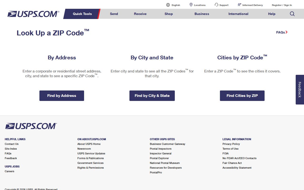
USPS ZIP Code Lookup is the authoritative postal route in the research. It has three modes: a full-address search, a city-and-state search, and a cities-by-ZIP search. The returned ZIP is a mailing assignment. It confirms neither a named person's residence nor the city-limit status of a parcel. Save the street, city, state, and any ZIP exactly as USPS standardizes them, then keep that result separate from the assessor's situs and mailing fields.
| USPS mode | Fields | Required fields | Result use |
|---|---|---|---|
| By Address | Company; Street Address; Apt/Suite/Other; City; State; ZIP | Street Address, City, State | Checks the delivery ZIP for a specific address. Company, unit, and ZIP are optional. |
| By City and State | City; State | City and State | Finds postal ZIP information for a city and state query. |
| Cities by ZIP | ZIP | ZIP | Checks city information associated with a known ZIP. |
| Find | Search control | After required fields | Runs the selected USPS query. |
The USPS Shelbyville ZIP lookup shows the address, city/state, and ZIP search modes.
Use the standardized postal answer as the delivery reference, then turn to parcel or planning records for a question about the physical property or municipal geography.
Searching Shelbyville ZIP Codes
A ZIP narrows a delivery question first. Once an address is confirmed, the next record depends on the ZIP class and the question. For 37160, a street or subdivision can lead to property parcels. For 37161, explain the unique-destination designation rather than treating it as a household area. For 37162, a named person or organization may be researched through a permitted record, but the PO Box cannot be treated as a residential location. A ZIP alone should result in a postal-area explanation, not a named-resident list.
- Enter the complete known address in USPS By Address mode and save the standardized result.
- Identify whether the result is 37160 standard delivery, 37161 unique delivery, or 37162 PO Box service.
- For a 37160 property question, use the street, subdivision, owner, or parcel controls in TPAD, then compare county GIS or planning material.
- Keep postal ZIP, assessor situs address, assessor mailing address, and recorded legal description as separate dated fields.
- Ask USPS about a disputed delivery ZIP, and ask the Assessor, Register of Deeds, Planning, or GIS office about the separate property question.
Street-level parcel work belongs with the Street Directory route after USPS has helped standardize the address. The ZIP code directory remains most useful when it keeps postal, property, and municipal questions separate.
Shelbyville ZIP Code Parcel Controls
Tennessee Property Assessment Data is a parcel-centered resource, not a ZIP-wide search. Its advanced form exposes Owner, Property Address, Subdivision Name, Classification, Sale Date Start, Sale Date End, and Control Map, Group, and Parcel parts. A simple search accepts county and a term that can be an owner, street address, or parcel ID. Results can be sorted by owner name, property address, parcel ID, subdivision, classification, or sale date.
TPAD does not expose a ZIP field. Do not claim there is a public TPAD ZIP search. For a Shelbyville 37160 address, use the street or subdivision controls after USPS confirmation, then refine with Bedford County context. The property card can show an owner, property address, mailing address, values, classification, and sale history, but it does not establish who currently occupies the property.
The assessor's separate mailing field can differ from USPS delivery information without showing a ZIP error. Compare the date, parcel key, property address, and recorded legal description before asking a custodian to correct anything.
| Property or situs address | The parcel's physical property address as the assessor stores it. |
|---|---|
| Mailing address | The address used for tax correspondence. It can differ from the property address or use a PO Box. |
| Parcel ID | Bedford uses control map, group, and parcel components. It bridges maps, deeds, and planning records. |
| Legal description | The recorded parcel language, such as lot, block, subdivision, or metes and bounds. It is not a ZIP. |
Shelbyville ZIP Code Voter Limits
The Tennessee voter lookup has no address or ZIP input. It requires county, first name, last name, birth month, and birth year, and it is designed as a known-identity registration and absentee-status check. It is not a public ZIP browser, street directory, or block list. The source did not expose a full successful-match record, address display, public ZIP filter, downloadable-file rules, current fee, or delivery format for broader voter material.
The Bedford County Election Commission is the correct human route for an apparent mismatch, registration status, address update, or question about a lawful request. A name result should not be used to reconstruct an address from a ZIP, precinct, or unrelated parcel record. Public election administration data and the individual public search do not have the same scope.
TPAD and the voter tool illustrate the local split. TPAD is property-centered and can use a street, owner, subdivision, or parcel ID, but it has no public ZIP field. The voter tool is person-centered and requires a known identity, but it has neither an address nor a ZIP field. Neither route produces a Shelbyville ZIP-wide household list.
Note: The public voter tool is identity-centered, while a Shelbyville ZIP code directory question is postal and geographic.
Shelbyville ZIP Codes and City Lines
Postal delivery geography does not match municipal geography. Shelbyville Planning explains that annexation adds county land to the city and extends city services, laws, taxes, and voting privileges. A parcel can therefore have a Shelbyville postal address while an older deed, assessment, or planning record uses a county reference. City population figures are also city statistics, not ZIP counts. No official ZIP-specific population or registration statistics were located.
Parcel identifiers are not ZIP identifiers. TPAD uses control map, group, and parcel components. Planning files may use tax-map references, and a deed may use a subdivision lot or metes-and-bounds description. Use those identifiers to decide whether records describe the same property. Do not treat a delivery ZIP change, address typo, or different preferred city name as proof of a new parcel.
The observed Bedford parcel format uses a Control Map such as 012 or 100A, a Group such as B or AA, and a Parcel such as 025.00. These components give the assessor, deed, and planning records a shared property key. A ZIP is a delivery label added alongside that property evidence, not the bridge between records.
No official public street-renumbering chronology or current ZIP boundary map was located. That is a reason to preserve the exact record key and ask the appropriate custodian, not to draw an unverified line.
Shelbyville ZIP Code Map Geography
Postal, parcel, and city layers are maintained by different offices. The Bedford County Media/GIS route describes county mapping work, including property lines, rights-of-way, annexations, transfers, and property-line alterations. Shelbyville separately provides a city ArcGIS zoning-map route. The active county parcel viewer URL, individual layer names, identify controls, and ZIP capability were not confirmed in the inspected source.
Planning materials can connect a project address to owner or developer information, tax ID, current zoning, and adjoining-owner fields. They are project records, not an all-purpose ZIP index. The zoning map and county mapping entry can help distinguish city planning context from county parcel geometry after a postal address has been verified.
For a disputed city-limit question, contact Planning or GIS. For a disputed parcel identity, use the Assessor and Register of Deeds. For a disputed mailing ZIP, use USPS. Those separate routes preserve the geography that each office actually controls.